

Barren River Lake Water Level: How to Check It and What It Means

Updated: 1 hour ago
If you are planning a trip, the Barren River Lake water level is one of the first numbers to check. It gives context for exposed shoreline and high-water conditions, but it cannot tell you by itself whether a ramp or dock is open or suitable. USACE manages the reservoir at Barren River Dam, with seasonal operating targets that help explain the readings.
Why the Barren River Lake water level changes
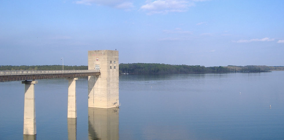
Barren River Lake isn't a natural lake. It was authorized under the Flood Control Act of 1938, construction on the dam began in March 1960, and the lake became operational in October 1964. Its first job is flood control for the Barren and Green river valleys, and the drainage area above the dam covers about 940 square miles. The Corps also manages it for recreation and water supply. USACE project history.
That flood-control role is why the level moves. The Corps keeps the lake higher in summer for boating and lowers it in fall and winter, which leaves room to store runoff during the wetter months. According to the Corps, the lake covers about 10,000 acres at normal summer pool and can reach 20,150 acres at maximum flood control pool. USACE reservoir information.
Summer pool and winter pool, in plain numbers
Summer pool: USACE’s published pool reference lists 552 feet above mean sea level. This is a target reference, not a current reading. USACE pool reference.
Winter pool: the same USACE reference lists 528 feet, 24 feet below summer pool. Confirm current operating targets and notices. USACE pool reference.
Fall drawdown: the timing and rate vary with water-management needs. Use a current USACE announcement, not a previous year’s dates, when planning a trip.
Spring refill: the lake is raised back toward summer pool in spring, ahead of the boating season.
Exact dates can shift from year to year with weather and operations, so treat these as a guide and confirm the current plan with the Corps.
How to check the level before you go
Use the USACE project page’s lake-level resources or USGS monitoring station 03312900 near Finney. Check the reading’s timestamp, units and vertical datum before comparing it with a published pool reference. A graph or old screenshot is not a forecast for your travel date. USGS monitoring station. USACE lake-level resources.
USGS Barren River Lake Near Finney monitoring station: check the observation time and available elevation data. USGS station03312900.
The Barren River Lake project office: (270) 646-2055, or its daily information line at (270) 646-2122. Confirm office hours before calling. USACE contact information.
Corps of Engineers announcements and local news, which usually carry drawdown and refill notices.
Your marina, which will know how the current level affects its slips, fuel dock and rental fleet.
What the number means for Barren River Lake boat ramps and docks
Even near summer pool, a ramp or courtesy dock may be closed or unsuitable for your boat. As water drops, ramp ends can be exposed and coves become shallower. KDFWR specifically warns that Port Oliver is not usable at lower winter drawdown levels. Check the operator’s notice before towing, and proceed cautiously around unfamiliar shallows or debris. Port Oliver low-water warning.
High water is the other side of it. After heavy rain the Corps may hold water above summer pool to protect the valleys downstream. That can put parking areas, beaches and low ramps underwater and carry debris into the main lake. If the elevation is well above 552, call ahead before you load the family.
Barren River Dam and the tailwater
Below Barren River Dam, conditions depend on releases and river flow rather than the lake elevation alone. KDFWR describes fishing opportunities for hybrid striped bass, white bass and catfish. Check discharge information and posted restrictions before approaching the tailwater; avoid entering fast or rising water. KDFWR tailwater information.
Weather and the lake
Lake level and weather go together. A few days of steady rain upstream can raise the lake quickly, while a dry late summer can leave it running a little under target. Pair the elevation reading with a weather forecast for the Glasgow and Scottsville area, and keep an eye on afternoon storms in summer, when open water is the wrong place to be.
We'll share drawdown dates, ramp notices and other lake news in this category as the Corps announces them.
Planning a future RV trip to enjoy the lake and surrounding outdoors? The Resort at Barren River Lake is under construction and is not open yet. Our RV-sites-only resort is across the road from the lake, with no cabins now or planned and no direct lake access from the property. Join the waiting list for opening updates, then explore the area for ideas to include in your trip.

Comments